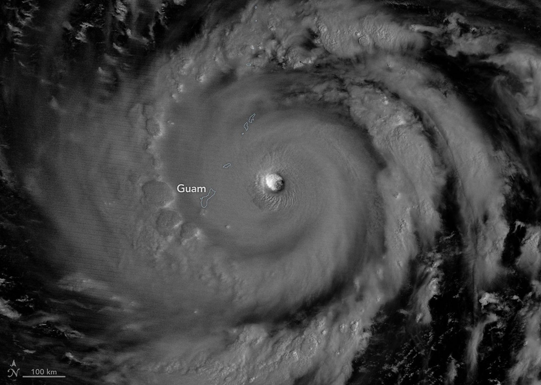
Satellite imagery captured during early July 2026 shows Super Typhoon Bavi rapidly strengthening as it tracked across the western Pacific toward the Northern Mariana Islands and Guam before continuing toward East Asia. High-resolution observations from NOAA-21's Visible Infrared Imaging Radiometer Suite (VIIRS) reveal the storm's well-defined eye and expansive cloud structure as forecasters monitored its evolution.
Modern Earth-observation satellites provide emergency managers with near-real-time information about tropical cyclone intensity, track and cloud development, helping improve forecasts and support disaster preparedness across the Asia-Pacific region. These data are particularly valuable for protecting coastal communities and critical infrastructure in the storm's projected path.
Image Credit: NASA Earth Observatory image by Michala Garrison, using NOAA-21 VIIRS data
Featured Images
Super Typhoon Bavi Intensifies Over the Western Pacific