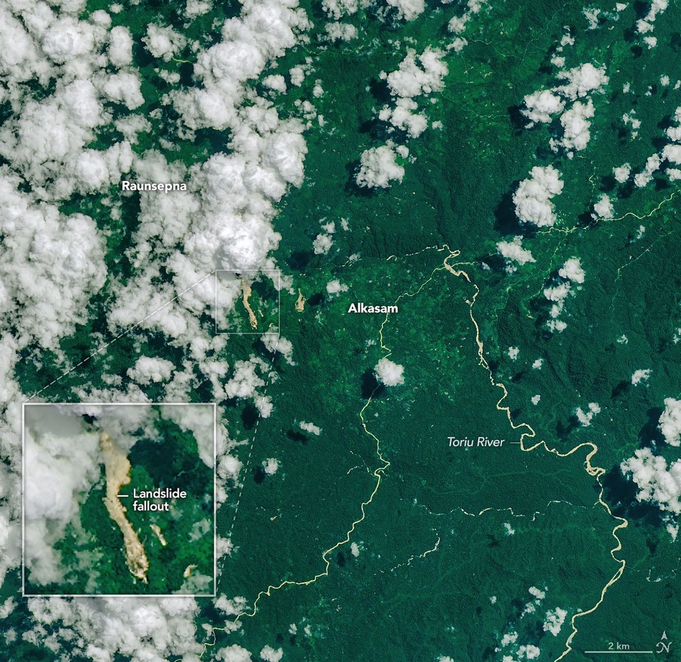
 Heavy rains triggered by a tropical cyclone have caused widespread landslides across Papua New Guinea, with satellite imagery providing a detailed look at the damage. The imagery reveals clusters of landslides cutting through forested terrain, highlighting the scale of the event.
Using data from multiple satellite systems, scientists were able to identify high-risk zones and map the extent of slope failures. The combination of rainfall intensity data and terrain modeling helps explain where and why the landslides occurred.
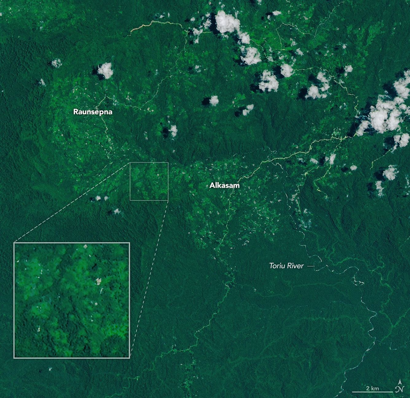
The Landsat 9 satellite captured an image (top) of the fresh landslide scars cutting through the dense tropical forests in the Baining Mountains on April 20, 2026. The Toriu River and other sediment-laden waterways are visible to the east of the landslides. The landslides appear as light-brown swaths of exposed soil and debris extending north toward a nearby river valley, contrasting with the surrounding green vegetation and scattered white clouds. A second image (bottom) from Landsat 9 shows the same area on Sept. 24, 2025, before the landslides.