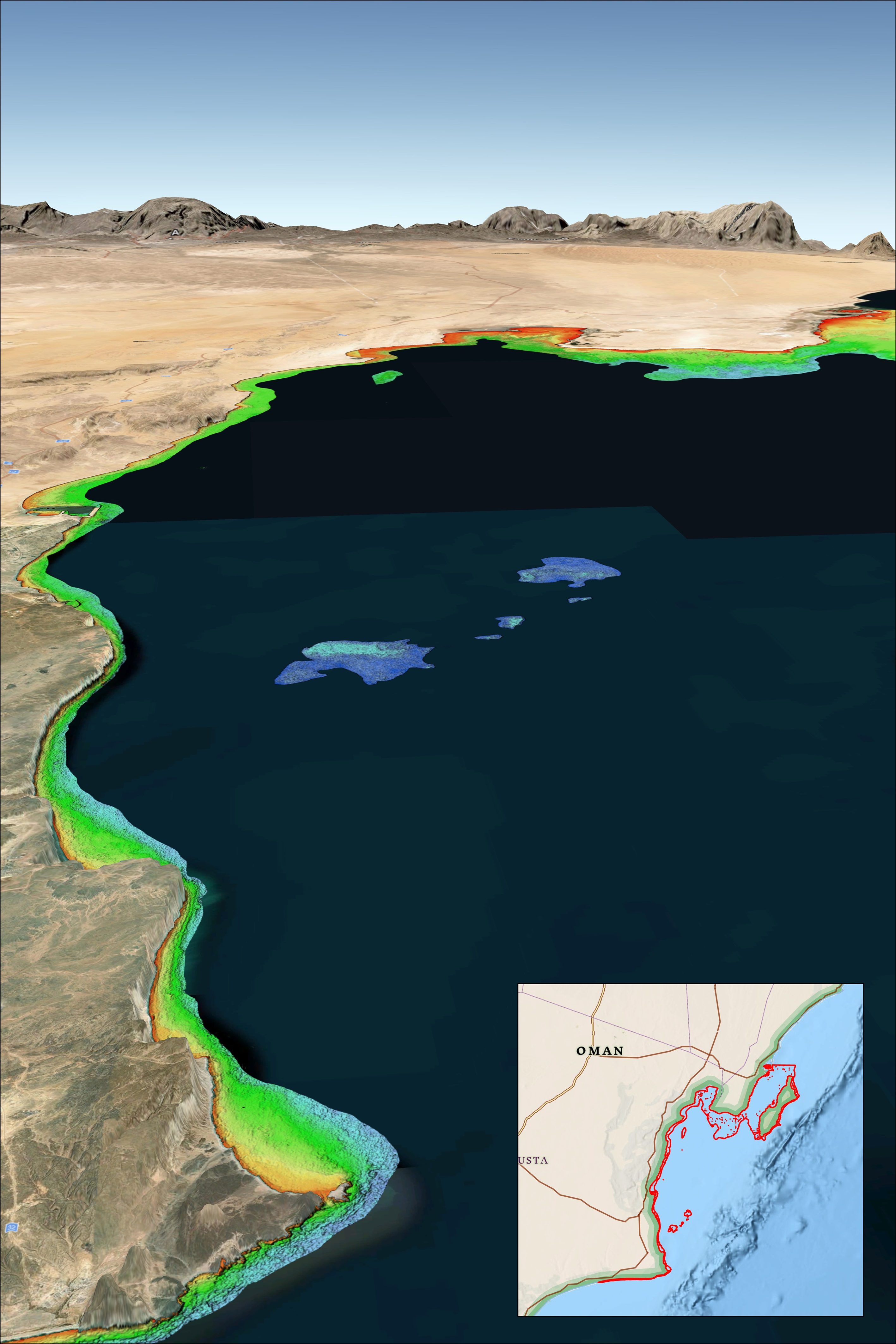
For more than 10 years, TCarta has been supplying marine charting organizations with water depth data using a technique called Satellite Derived Bathymetry (SDB). SDB applies physics-based computer algorithms to optical imagery captured by commercial remote sensing satellites. This analysis detects and measures light reflecting off the seafloor to calculate water depth. Depending on water clarity, SDB is routinely accurate to depths of 20 to 30 meters.
The off-the-shelf bathymetry product Global Satellite Derived Bathymetry (G-SDB) offers 10-meter detail and is ideal for identifying coastal shoals in remote areas that don’t appear on nautical charts. Large-area contiguous G-SDB products are immediately available for more than a dozen critical locations, including:
- South China Sea
- Arabian/Persian Gulf
- Gulf of Oman
- Red Sea
- Black Sea
- Eastern Mediterranean
In the accompanying image, TCarta SDB data on the Oman Coast indicate shallow water depths by color. Red represents 0-3 meters, yellow is 3-6 meters, green is 6-10 meters, turquoise is 10-14 meters, and blue is 14-18 meters deep. Inset map indicates geographic location of dataset. [Credit: TCarta Marine]