Vexcel Brings Aerial Imagery and Geospatial Intelligence to AI Platforms
Access Vexcel imagery and geospatial data within any MCP-compatible AI platform, including ChatGPT, Claude, Microsoft Copilot, and Gemini. CENTENNIAL, Colo.-...
Geospatial1 brings Earth Imaging Journal, Sensors & Systems and Asian Surveying & Mapping together as one publication. V1 Media is the parent of Geospatial1 and Informed Infrastructure.
Access Vexcel imagery and geospatial data within any MCP-compatible AI platform, including ChatGPT, Claude, Microsoft Copilot, and Gemini. CENTENNIAL, Colo.-...
The Uttar Pradesh government yesterday launched the statewide Digi Rover-GNSS Special Land Measurement Campaign, which will run until August 15. Chief Minister...
With key infrastructure and agreements in place, the companies progress pad construction at Launch Complex 3C for Firefly’s Alpha rocket. SSC Space and Firefl...
Firefighter Location and Lifesaving Situational Awareness Technology Launched on the Memorial Anniversary Honoring Fallen Fighters LAKEWOOD, COLO. (June 30,...
AI-driven software stack provides situational awareness and high-fidelity tracking for complex ground-based intelligence, surveillance and reconnaissance missio...
Des Plaines, IL – (June 25, 2026) The GIS Certification Institute (GISCI) is pleased to announce that Captain Amilynn E. Adams, GISP®, has been elected as th...
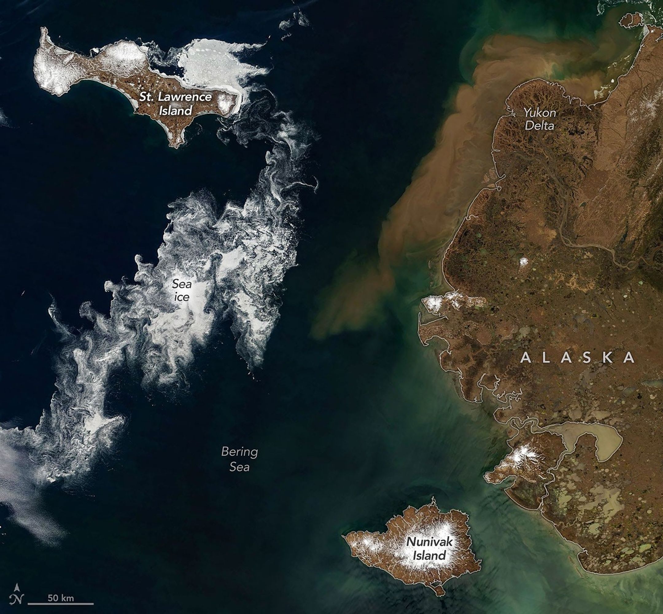
Satellite imagery collected during late June 2026 reveals widespread seasonal ice retreat across the Bering Sea, highlighting ongoing changes in one of the worl...
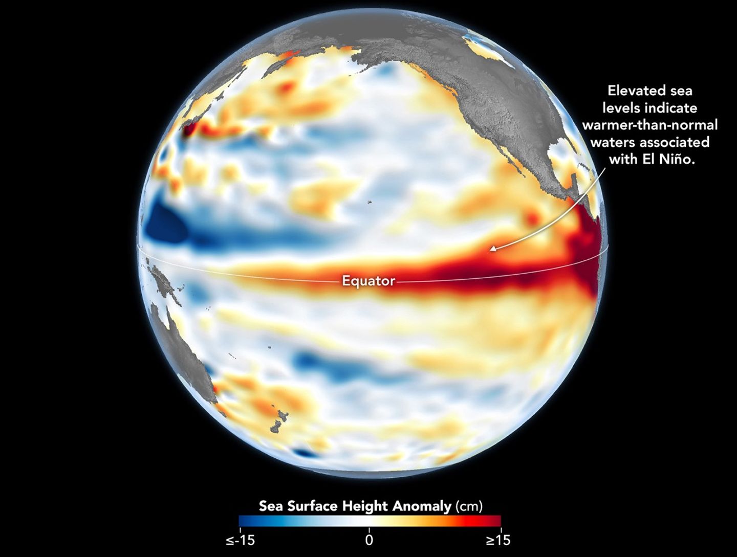
Scientists are closely monitoring the return of El Niño conditions as warming sea-surface temperatures in the tropical Pacific begin influencing weather pattern...
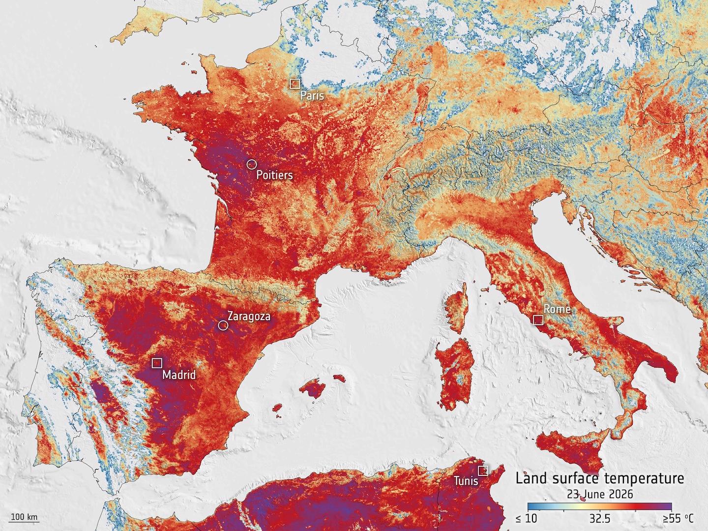
Large portions of Europe experienced another intense early summer heat wave as temperatures climbed well above seasonal averages across southern and western reg...
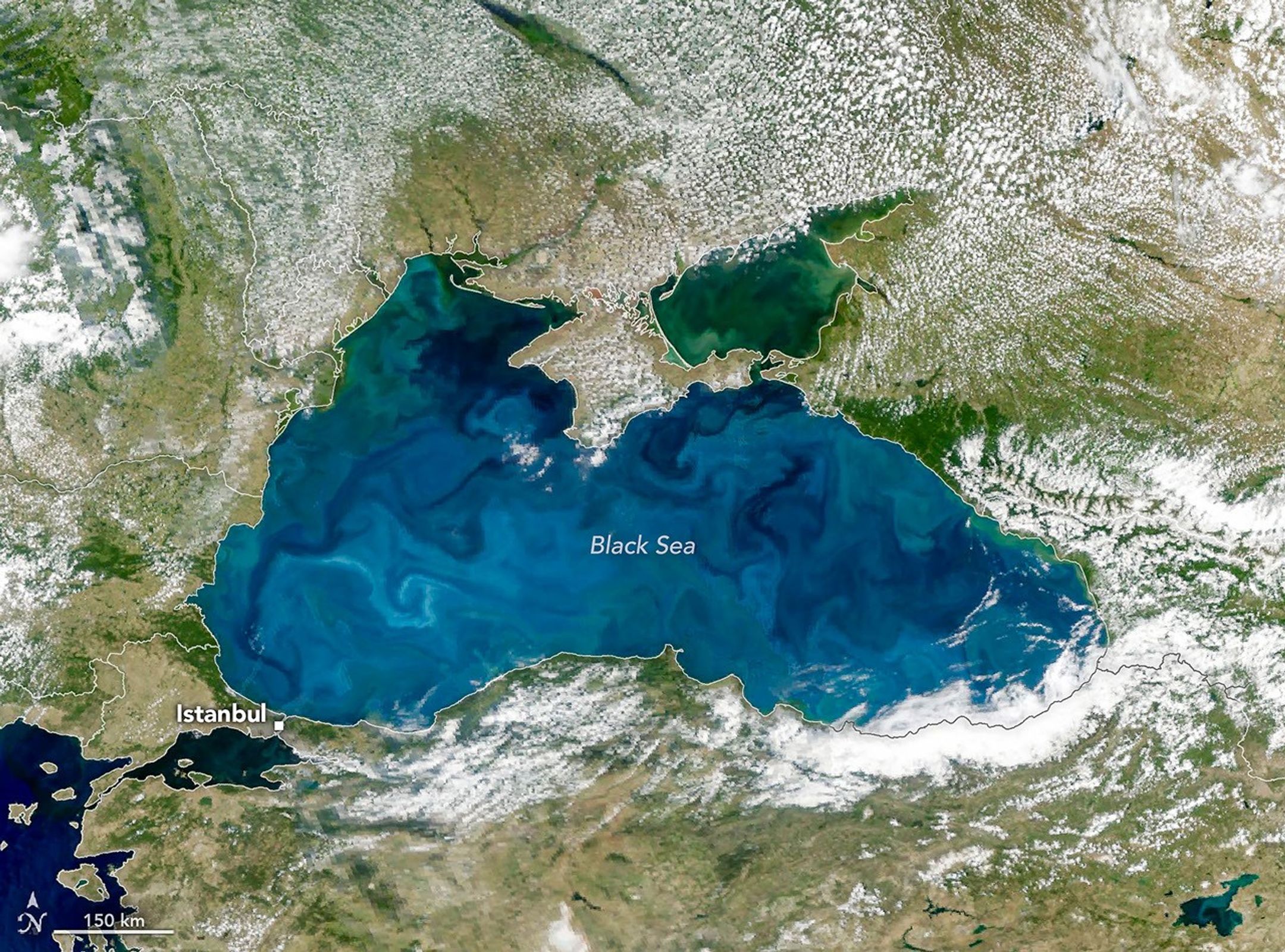
An unusual burst of turquoise color spread across portions of the Black Sea in late June 2026, creating a striking scene captured by NASA's Earth Observatory. T...