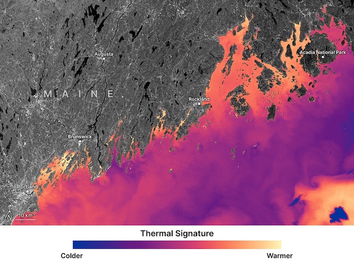
This false-color image from Landsat 9’s Thermal Infrared Sensor, acquired Oct. 11, 2025, shows the thermal signature of waters off the coast of Maine—revealing finer-scale temperature differences between neighboring coves. Cooler waters appear purple and blue, while warmer water shows up in orange and yellow.
Landsat 8 and 9’s pixels—98 to 328 feet (30 to 100 meters) across—can distinguish subtle temperature differences between neighboring coves. For a cold-blooded oyster, those distinctions can translate into months of growth. Warm water accelerates feeding and shell development. Cold water slows both.
Image Credit: NASA/Ross Walter and Allison Nussbaum, using Landsat data from the U.S. Geological Survey
NASA Data Helps Maine Oyster Farmers Choose Where to Grow