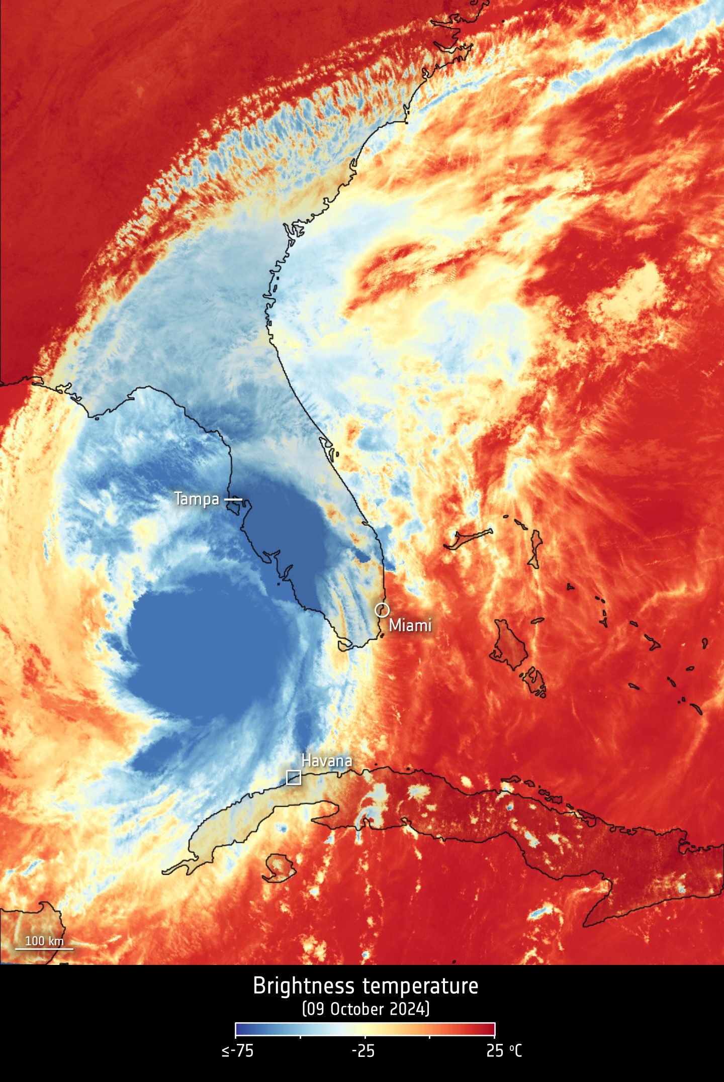
The Copernicus Sentinel-3A satellite took the temperature at the top of Hurricane Milton as it headed across the Gulf of Mexico toward Florida on Oct. 9, 2024. The storm subsequently ripped through the state, destroying homes, buildings and power lines, and lives were lost. This image shows the brightness temperature at the top of the storm, which ranges from about -75°C at the center of the storm to -25°C at the storm edges. Over the sea and land, temperatures are around 25°C.
Image Credit: Contains modified Copernicus Sentinel data (2024), processed by ESA
Hurricane Milton Viewed by Sentinel-3