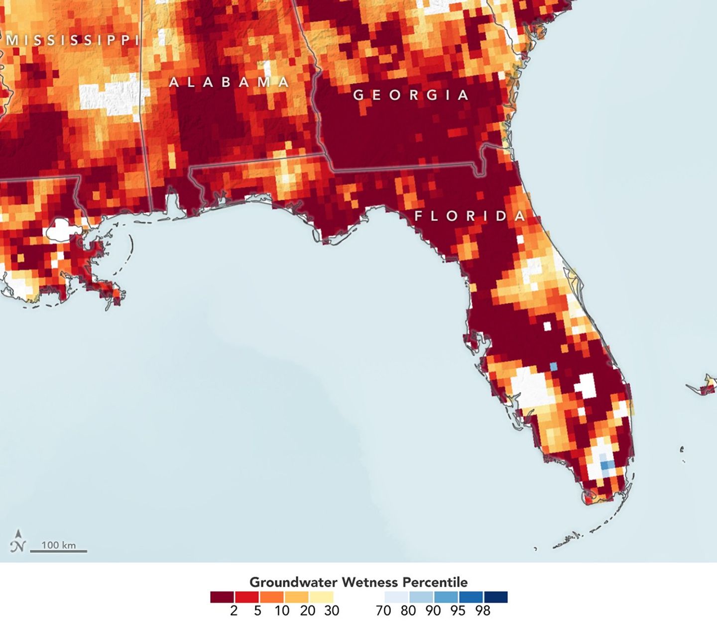
Nearly all of Florida faced at least “moderate” drought in April 2026, and nearly 80 percent of the state fell under “extreme” conditions—some of the worst on record. The Floridan aquifer dropped to its lowest levels since 2011, prompting water-management districts to issue mandatory outdoor watering restrictions across multiple regions.
The map above combines data from the twin GRACE-FO (Gravity Recovery and Climate Experiment Follow-On) satellites and ground-based measurements to estimate the relative amount of groundwater stored underground as of March 30, 2026. The colors depict the wetness percentile, or how the amount of shallow groundwater compares to long-term records (1948–2010). Blue areas have more water than usual, and orange and red areas have less. Aquifers in the northern and central regions of the state are particularly dry.
NASA Earth Observatory images by Lauren Dauphin, using GRACE-FO data from The National Drought Mitigation Center at the University of Nebraska-Lincoln.
Top Stories
Drought-Parched Florida Mapped from Space