[caption id="attachment_465561" align="aligncenter" width="610"] View the full animated gif on the EIJ homepage at www.eijournal.com. [/caption]
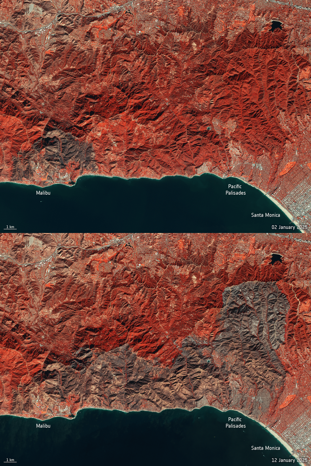
This pair of Copernicus Sentinel-2 images highlights the vast area impacted by one of the wildfires that has been ravaging the Los Angeles region.
The images vividly illustrate the extent of the burned land between Jan. 2-12, 2025, as a result of the wildfire around the Pacific Palisades, one of the most destructive fires in California history. According to the Los Angeles Fire Department, to date almost 100 square kilometers have been affected by this fire alone. In a disaster of epic proportions, the area around Los Angels has been doing battle with a further four fires. Tinder dry ground and strong winds have been blamed for these vast fires.
The images use Sentinel-2’s near-infrared band to highlight vegetation in red, the burned area appears in black.
Image Credit: Contains modified Copernicus Sentinel data (2025), processed by ESA
Animation Shows Land Burned by Palisades Wildfire